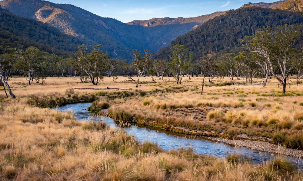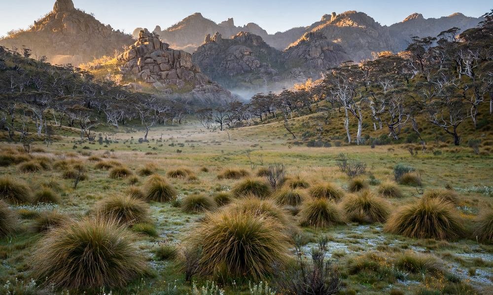

Just 45 minutes south of Canberra, the city ends and the mountains begin. Namadgi National Park covers close to half of the Australian Capital Territory, and it feels like a different world: granite peaks, wide grassy valleys, snow gum forests, and quiet trails where kangaroos outnumber people. Entry is free, with easy 1 km loops for beginners and multi-day mountain treks for fit walkers, and you can be back in the city for dinner or camp under the stars. This guide from Australia City Guide covers the best walks, the rock art, the old huts, where to camp, and how to plan a day that actually works.
Why Visit Namadgi National Park
Namadgi is the ACT’s only national park, and it is a big one. At 106,095 hectares it takes up about 46% of the territory, and it forms the northern end of the Australian Alps. It shares a border with Kosciuszko National Park in New South Wales, so the country here feels wilder than most people expect so close to a capital city.
What makes it special is the mix. You get ancient granite tors and high peaks, open grassland valleys full of kangaroos, quiet rivers where platypus live, and one of the most important Aboriginal rock art sites in south-east Australia. And because there are no cafes, no shops, and no crowds of tour buses, the park stays calm even on a fine weekend. If you like walking, wildlife, and wide open space, this is the best day trip from Canberra you can do.
It is also easy to reach. The Namadgi Visitor Centre sits on Naas Road at Tharwa, about 45 to 60 minutes from the city centre. Start there, pick one walk, and you have a proper mountain day without a long drive or an entry fee.
A Short History of Namadgi
The Ngunnawal people have lived in this country for at least 21,000 years. They moved with the seasons, spending winters in the lower valleys and summers in the high country, where Bogong moths were gathered as food. Rock art, stone tools, and axe-grinding grooves are still found across the park, and the Yankee Hat paintings you can visit today are around 800 years old. In 2001 the ACT Government and Ngunnawal community leaders signed an agreement that recognises the Ngunnawal people as the traditional custodians of the park, and the park is now managed jointly.
European settlers arrived in the 1820s and 1830s and cleared the valleys for grazing. Old homesteads and huts from that time still stand, and you can walk to several of them. The park itself was created in 1984, not just to protect wildlife but to protect Canberra’s water supply. The Cotter catchment inside the park feeds the reservoirs that supply much of the city’s drinking water, so the country is looked after with that in mind too.
Fire has shaped Namadgi more than once. The 2003 Canberra bushfires burnt about 98% of the park, and the 2020 fires burnt about 80% of it. Recovery is easy to see as you walk: blackened trunks next to fresh green growth, and new plants coming back in the valleys. The southern loop of the park around Boboyan Road escaped the 2020 fire, which is one more reason the old huts down there are worth a visit.
What to See and Do in Namadgi
The park is about walking, looking, and slowing down. There is no single headline sight to tick off, so pick one or two things per visit and do them well. These are the experiences that make a Namadgi day worth the drive.
See the Yankee Hat Rock Art
This is the one thing to do if you only do one thing. The Yankee Hat walk is a 6.5 km return trip across open grassland, about 3 hours at an easy pace, and it ends at the ACT’s only publicly accessible Ngunnawal rock art shelter. The paintings show kangaroos, dingos, emus, and people, and they have survived here for hundreds of years. Stay behind the viewing area and never touch the painted rock. The walk starts from an unsealed road, so ask at the Visitor Centre about the road before you set off. Go early and you will likely share the grassland with kangaroos.

Walk to Cypress Pine Lookout
If you want a view without a huge climb, this is the walk. Cypress Pine Lookout is a 4.5 km return walk from the Visitor Centre, about 2 hours, and it suits most fitness levels. The track climbs through woodland to a lookout over the valley, and it is the honest turnaround point for a mixed group. Mount Tennent summit is a separate and much harder day, so don’t let the lookout tempt you into the full climb unless you planned for it.
Climb Booroomba Rocks
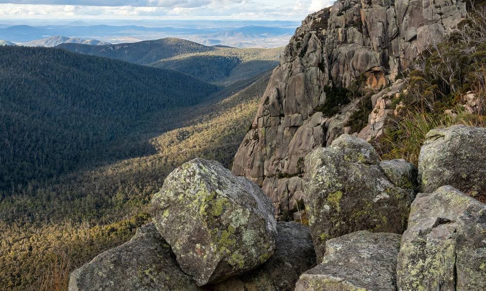
Booroomba Rocks is the park’s signature granite climb: big boulders, open slabs, and wide views over the Orroral Valley. From the car park the walk is about 5 km return and takes around 1.5 hours, but it is steep and exposed, so take your time and stay well back from the cliff edges. Check the road before you go. Booroomba Rocks Road has been closed, and while the walking track is listed as open, the only access when the road is shut is a long walk in from Honeysuckle Campground along the Australian Alps Walking Track, about 10.5 km. Rock climbers also use the cliffs here, and Rendezvous Creek nearby has established climbing routes too.
Wander Square Rock
Square Rock is a 10.5 km return walk, about 4.5 hours, through snow gums and granite slabs on Corin Road. It is a good middle-ground walk: long enough to feel like a real day out, but not as hard as the big summits. A metal ladder helps you over the last rocky step near the top. Gibraltar Falls is close by on the same road, but check the lookout status before you count on it, as it was closed in the latest Parks ACT update we checked.
Step Back in Time at the Heritage Huts
Namadgi holds some of the best historic huts in the Australian Alps, left over from the grazing days. Orroral Homestead, built in the 1860s, is the oldest hut in the park and an easy walk from Orroral Campground. Gudgenby Homestead dates from 1845 and has been restored to its original state. Brayshaws and Westermans Homesteads sit on Boboyan Road along the Settlers Track, and Brandy Flat Hut from the 1900s is a popular stop for walkers and cyclists on the Brandy Flat Firetrail. Horse Gully Hut near Mount Clear Campground was built during the Second World War. The huts are day shelters and emergency use only, and the Huts Code applies, so bring a tent if you plan to stay the night anywhere near them.

Look for Wildlife
Come at dawn or dusk and the park puts on a show. Eastern grey kangaroos graze the grasslands around Orroral Valley and Yankee Hat, wombats work the lower slopes, and wallabies slip through the bush at the track edges. Platypus live in the Gudgenby, Cotter, and Orroral rivers, though you need patience and a quiet dawn to spot one. More than 200 bird species have been recorded here, from wedge-tailed eagles circling the ridges to flame robins and superb lyrebirds in the forest. The rare mountain pygmy possum lives in the boulder fields of the Bimberi Range, but you are very unlikely to see one. Keep your distance, never feed any animal, and slow down on the roads at dusk.
Drive the Scenic Roads
You don’t have to walk far to see good country here. The roads are sealed to Tharwa and along Corin Road, and beyond that the Boboyan, Old Boboyan, and Brindabella roads are unsealed but usually fine for a normal car when dry. Hospital Hill Lookout on Boboyan Road has signs that explain the mountain geography, and the views are wide. If you have time and a full tank, Bendora Arboretum in the north-west of the park is a quiet detour: it was planted in 1940 as a trial of which trees would grow in Canberra, and it now holds 52 species. The walk there is a 5 km return Grade 2 loop, but the drive in via Brindabella Road and Mount Franklin Road takes over 90 minutes from the city, so treat it as its own trip. Ginini Flats, high in the ranges, is the only Ramsar-listed wetland in the ACT and a haven for alpine plants and birds.
Snow and Winter on the High Country
Winter changes the park completely. Snow falls on the Bimberi and Brindabella ranges, and it can fall on the high peaks in any month of the year. Higher roads may need snow chains or may close, so check with the Visitor Centre before you drive up. This is not a ski resort, and the backcountry skiing on Mount Franklin is only for skilled skiers with the right gear. If you want a simple snow day with the kids, Corin Forest Mountain Resort sits just outside the park on Corin Dam Road and has a ski area, a snow play area, and an alpine slide.
Rock Climbing and Fishing
Climbers head to Booroomba Rocks and Rendezvous Creek, where established routes suit a range of skill levels. Anglers can try for trout in the park’s rivers and streams, but check the licence rules at the Visitor Centre before you cast a line, as the rules change and parts of the Cotter catchment have their own restrictions.
The Best Walks in Namadgi
There is a walk here for every level, from a 1 km loop at the Visitor Centre to multi-day treks through the Bimberi Wilderness. This table puts the main walks side by side so you can pick one that fits your day. Times are for a steady walker, and they don’t include stops.
| Walk | Grade | Distance | Time |
|---|---|---|---|
| Woodland Walk | Grade 2 | 1 km loop | 30 to 45 minutes |
| Yankee Hat rock art | Grade 3 | 6.5 km return | 3 hours |
| Cypress Pine Lookout | Grade 3 | 4.5 km return | 2 hours |
| Square Rock | Grade 3 | 10.5 km return | 4.5 hours |
| Booroomba Rocks | Grade 4 | 5 km return | 1.5 hours from the car park |
| Mount Tennent lookout | Grade 4 | Return walk | 2 hours |
| Mount Tennent summit | Grade 4 | 15 km return | 6 hours |
| Settlers Track | Grade 3 | One-way track with huts | 4 to 5 hours |
| Mount Gingera | Hard | Long day walk | 6 hours from Mount Franklin Road, or 8 to 9 hours via Stockyard Spur |
| Mount Bimberi | Grade 5 remote | Multi-day | Via the Australian Alps Walking Track |
A few honest rules will save your day. Pick one big walk per day and stick to it. Gingera, Booroomba from Honeysuckle, and the Australian Alps Walking Track are not afternoon add-ons after a morning walk. Check the track and road status at the Visitor Centre before you start, because closures change with rain, snow, and fire recovery work. And if the weather turns, the Woodland Walk or the Visitor Centre is a fine fallback. Changing plans is good sense, not a failed day.
Two walks deserve a special note. Mount Gingera is a hard 6-hour day from Mount Franklin Road, or 8 to 9 hours via Stockyard Spur from Corin Dam, and it needs an early start and a night in Canberra before it. Mount Bimberi, at 1,911 metres, is the highest peak in the ACT and a remote multi-day walk through the Bimberi Wilderness. Both are for fit, well-prepared walkers only. The Australian Alps Walking Track runs through the park as part of its 640 km route from Walhalla in Victoria to Canberra, and the Namadgi section is a serious multi-day commitment.
How Many Days Do You Need?
Namadgi works as a half-day trip, a full day, or a weekend. The right length depends on what you want to walk, not on how much you want to see. Here is an honest guide.
3 hours: Visitor Centre, the Woodland Walk, or Cypress Pine Lookout. This fits a Canberra afternoon if you leave on time, and it suits families and first-timers.
Half day: Yankee Hat, including the unsealed drive in and out. Leave the city with a clock, ask at Tharwa first, and don’t add a second walk.
Full day: one granite walk, either Square Rock or Booroomba, or Mount Gingera with a first-light start. You will be walking most of the day after the drive, so pack lunch and plenty of water.
Overnight or weekend: camp at Orroral or Honeysuckle and pair it with one valley walk. This is the realistic way to see the park properly, and it is the only sensible option for the Settlers Track or a Bimberi trip.
3 days: add the Settlers Track and Mount Tennent, with a camp night between them. By then you will have seen the rock art, the huts, the granite, and a summit, which is a fair taste of the park.
Sample Itineraries
Use these as starting points, then adjust them to your fitness and the weather on the day.
Half-Day: Visitor Centre and Cypress Pine
Drive from Canberra to Tharwa in the morning and stop at the Namadgi Visitor Centre first. Pick up a map, check the road and track alerts, and ask the rangers what suits the day. Walk the 1 km Woodland Walk to stretch your legs, then take the 4.5 km return track to Cypress Pine Lookout for views over the valley. Have lunch back at Tharwa or in Tuggeranong on the way home. This plan suits families, older walkers, and anyone short on time. For more easy options close to the city, see our guide to free things to do in Canberra.
Full Day: Yankee Hat and Orroral Valley
Leave Canberra early and head for the Visitor Centre. After a quick check on road conditions, drive south on Boboyan Road to the Yankee Hat trailhead and walk the 6.5 km return to the rock art shelter. Take your time on the way back and watch for kangaroos in the grassland. In the afternoon, drive to Orroral Valley, walk the short track to Orroral Homestead, and look for wombats and wallabies as the light softens. Drive back to Canberra for dinner. This is the best single day in the park for most visitors.
Weekend: Camp at Honeysuckle and Walk Booroomba
Book a site at Honeysuckle Campground through Parks ACT before you leave, and arrive on Friday afternoon or Saturday morning. Set up camp, walk the short tracks around the campground, and visit the site of the old Orroral Valley Tracking Station, which tracked NASA’s Apollo missions. On the second day, walk to Booroomba Rocks from Honeysuckle along the Australian Alps Walking Track, about 10.5 km, and take in the granite cliffs and the valley views. Camp a second night or drive back to Canberra in the late afternoon. This plan works best in autumn and spring, when the days are cool and the tracks are dry.
Best Time to Visit Namadgi
There is no single best month, only trade-offs between snow, heat, fire risk, and road closures. Here is how the seasons play out.
Summer: warm valley walking, alpine wildflowers, and long days. It is also snake season, and bushfire risk is real, so check the alerts and carry extra water. Yankee Hat and Orroral get busy on Canberra weekends.
Autumn: cool, clear days and cold nights, and one of the best walking windows of the year if the roads are dry. This is our pick for the big walks.
Winter: snow on the higher ranges, quiet trails, and a real alpine feel. Chains or closures are possible on the higher roads, and Gingera is a winter-skills day, not a first walk. If the Visitor Centre is talking snow and you have no winter skills, pick Cypress Pine or stay in Canberra.
Spring: wildflowers, full creeks, and mild days, with cold snaps still possible on the ridges. Ice can linger on granite in the shade, so watch your footing on the high walks.
In any month, remember that a fine forecast for Canberra city is not a forecast for the Brindabella ridges. The weather up high can change in minutes, with wind, fog, and sudden cold. Check the forecast and the Parks ACT alerts on the morning you leave.
Where to Stay
There are no hotels inside the park, and that is part of its charm. Your choices are to camp, book the old cottage, or base yourself in Canberra.
Camping Inside the Park
Vehicle camping is allowed only at three campgrounds, and bookings are essential through Parks ACT. Entry to the park is free, but camping is a separate paid system, with fees charged per person per night rather than per site. The usual limit is 7 nights in a row, and fees are reviewed each year, so check the current amount when you book.
Orroral Campground sits in a bush setting near Orroral Homestead, with gas barbecues, a shelter, toilets, and picnic tables. Caravans and trailers can get in, and it is a good pick for a first camp.
Honeysuckle Campground suits groups and is the current walking access point for Booroomba Rocks. The Australian Alps Walking Track passes through it, and the old tracking station site is close by.
Mount Clear Campground is remote and basic, reached by unsealed road. Tents and swags suit it best, and it is not a good pick for camper trailers or a first overnight. Bring your own drinking water and firewood, take all your rubbish out with you, and note that fire bans apply in summer. If the online booking page fails, phone the Namadgi Visitor Centre on 02 6237 5307.
Ready-Cut Cottage
For something different, Ready-Cut Cottage sits on Old Boboyan Road beside the Gudgenby River and sleeps up to eight people in three bedrooms. It is a real piece of park history and a cosy base for a group, but you need to bring your own bedding, towels, food, and firewood. Book it through Parks ACT and check current availability before you plan around it.
Staying in Canberra
Most visitors sleep in Canberra and drive in for the day. The city is 45 to 60 minutes from the Visitor Centre, and it has the full range of hotels, apartments, and places to eat. Our guide to where to stay in Canberra covers the best areas and options for every budget. Tharwa is the last village before the park and has few beds, and Queanbeyan works as an overflow option when Canberra is full. If you want to eat well after a day on the tracks, the best restaurants in Canberra are an easy drive from the park gate.
Getting to Namadgi and Getting Around
The park sits in the Australian Capital Territory, south-west of Canberra, and there is no public transport into it. You need your own car, and you need to pick the right door for the walk you want.
Tharwa and the Visitor Centre: from Tuggeranong, take Tharwa Drive to Tharwa, then Naas Road south to the Visitor Centre. This is the main entrance and the right door for the Woodland Walk, Cypress Pine, and Mount Tennent. The park boundary itself is about 19 km further south on Naas Road.
Corin Road: from Tuggeranong, head west on Point Hut Road, then Tidbinbilla Road to Corin Road. This is the door for Square Rock, Stockyard Spur, Mount Gingera, and Gibraltar Falls, and it is close to Tidbinbilla Nature Reserve, which pairs well with a Namadgi trip.
Boboyan Road south: from the Visitor Centre, Boboyan Road runs south to Yankee Hat, the Settlers Track, and Mount Clear Campground. It is unsealed, so check the condition at the Centre first.
Roads are sealed to Tharwa and along Corin Road. Beyond that, the unsealed park roads are usually fine for a normal car when dry, but snow, ice, and bog can close them at short notice. Fill your fuel tank and buy food in Tuggeranong before you head in, because there are no shops in the park and Tharwa is a small village. For a wider look at getting around the capital, see our getting around Canberra guide.
What to Pack
There are no shops in the park, so what you bring is what you have. Pack for the walk you are doing, not the walk you wish you were doing.
Short walk (Woodland Walk, Cypress Pine): 1 to 2 litres of water per person, snacks, a sun hat and sunscreen, a windproof shell, a warm layer, and grip shoes. Bring a card for the Visitor Centre, as it does not take cash. Screenshot the Parks ACT alerts on town Wi-Fi before you lose signal.
Granite day or Gingera: 2 litres of water or more per adult, lunch and emergency food, a headlamp, a map and compass or offline GPS, first aid gear, and a turnaround time agreed out loud before you start. Hire a personal locator beacon from the Namadgi or Tidbinbilla Visitor Centre if you are heading into remote country.
Overnight: a tent, because the huts are day or emergency use only and not a booked bed. Add a fuel stove, warm layers, waterproofs, and extra food. Firewood must be brought in or bought at the Visitor Centre, as collecting it in the park is not allowed.
Staying Safe in Namadgi
Namadgi is a wild park, and it rewards walkers who take it seriously. The weather can change fast, with snow possible on the high peaks in any month and heat stress a real risk on steep summer climbs. Dress in layers, carry a waterproof shell, and turn back if the weather closes in.
Most of the park has limited or no mobile reception, and 000 needs reception to work. Download the Emergency+ app, carry offline maps, and hire a personal locator beacon from the Visitor Centre for remote walks. Tell someone your plans before you go, and fill in a trip intention form at the Visitor Centre if you are heading off the main tracks.
Snakes are active in the warmer months, so watch where you put your feet and hands, and keep a safe distance from all wildlife. Dogs are not allowed in the park, with assistance animals excepted, and there is only a limited exception for dogs in vehicles travelling through on Boboyan or Brindabella roads. Check the current rules before you travel. Fire bans apply in summer, and unsealed roads can close after rain, so check the Parks ACT alerts on the morning you leave.
FAQs About Visiting Namadgi
Is there an entry fee?
No. Entry to the park is free and there is no day vehicle pass. Camping is a separate paid system that must be booked through Parks ACT.
How long is the drive from Canberra?
About 45 to 60 minutes from Canberra city centre to the Namadgi Visitor Centre at Tharwa. Yankee Hat is a longer unsealed drive beyond that, and Gingera is a full walking day after the drive, not a city afternoon.
Do I need a permit to walk in Namadgi?
No general day-walk permit is needed for the marked tracks. Pack camping is restricted in the Cotter catchment, and organised groups may need permits, so check the Parks ACT guide before you go.
Can I bring my dog?
No, dogs are not allowed in the park. Assistance animals follow official policy, and there is a limited exception for dogs in vehicles travelling through on Boboyan or Brindabella roads.
Is there phone reception in the park?
Most of the park has limited or no mobile reception. Download offline maps, carry the Emergency+ app, and hire a personal locator beacon from the Visitor Centre for remote walks.
Can I camp for free in Namadgi?
No. Camping is only allowed in the three designated campgrounds, Orroral, Honeysuckle, and Mount Clear, and it must be booked through Parks ACT, with fees charged per person per night.
Is Booroomba Rocks open?
The walking track is listed as open, but Booroomba Rocks Road has been closed, so the usual car park access is not available. The walk in from Honeysuckle Campground along the Australian Alps Walking Track is the current option. Confirm the live status with Parks ACT before you go.
Is Namadgi good for kids?
Yes, for the right walks. The Woodland Walk and the Visitor Centre suit young kids, and older kids will enjoy Yankee Hat and the wildlife spotting. Save Gingera and the granite climbs for fit teens and adults. For more family ideas in the capital, see our Canberra with kids guide.
Final Thoughts on Visiting Namadgi
Namadgi National Park rewards walkers who slow down. Pick one walk, check the alerts, fill the tank in Tuggeranong, and give the day the time it deserves. The rock art at Yankee Hat, the granite of Booroomba, the old huts of the Settlers Track, and the quiet of the Orroral Valley are all worth the drive, and they are all free to visit. Camp a night if you can, because the park feels different once the day visitors leave and the kangaroos take over the grasslands. For a first trip, the Yankee Hat day is the one to do. For a second trip, stay the night and walk the granite.